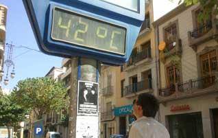
A MASS of warm air will bring an intense heatwave starting tomorrow (Friday) and lasting until at least Tuesday across the mainland and Balearic Islands, says the State meteorological agency, AEMET.
A 'surface anti-cyclone' and a warm front at high altitudes mean cloudy skies, brief showers and thunder storms to clear the air are unlikely.
'Yellow warnings' have been issued for the weekend in parts of Andalucía – the Guadalquivir river valley, which covers Sevilla and inland parts – as well as the southern half of the Castilla-La Mancha plains, the region of Valencia, the Ebro valley in Catalunya and the Ampurdán area of Girona (Costa Brava area), with temperatures in the shade reaching between 36ºC and 38ºC.
By Saturday, this will increase to the rest of Andalucía and the northern part of Murcia, and southern and inland areas are likely to see the mercury rise to 40ºC.
The whole of mainland Spain and the Balearics will be on 'yellow alert' by Sunday as thermometers rise even further – the Tajo, Ebro and Guadiana valleys will go up to 'orange alert' and only the Cantabria coast in the far north will escape weather warnings.
But Cantabria and its neighbours to the west, Asturias and Galicia, will hot up on Monday with temperatures hitting 40ºC – practically unheard-of in this part of the country where the weather is typically more like that of the UK than of the Mediterranean.
Night temperatures will also hit tropical levels, exceeding 20ºC in the southern half of the mainland and reaching 25ºC in some areas.