TEMPERATURES across Spain will return to normal for the time of year from this week after a disappointingly-cool and wet August, according to the State meteorological agency, AEMET.
Even in the hottest parts of the country – traditionally Andalucía and the Mediterranean – the mercury barely reached 30ºC throughout most of last month, and rainfall ranging from drizzle through to downpours with thunder and lightning blighted the holidays for those tourists heading to Spain for a sunshine beach break.
But from today (Monday), they can expect the temperature to rise again and, although some rain is expected today – which could be heavy on the Costa Brava – it is expected to subside by the evening and the rest of the week should be dry.
The mercury will start to fall in the Canary Islands and along the Cantabrian Sea coast – the northern stretch from the western Pyrénées to Galicia, directly above Portugal – but will rise in most of the Mediterranean in particular.
Showers are forecast in Catalunya along the coast and just inland from the shores, some of which may become torrential, and light rain and possibly thunder will be seen in the afternoon and evening in the Balearic Islands.
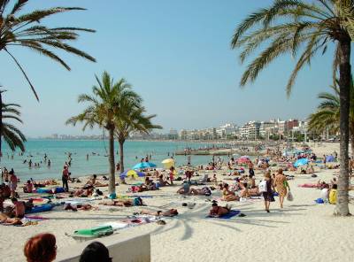
Elsewhere, mostly clear skies – albeit slightly cloudy in the morning in the Canaries and the northern third of the mainland – are expected all week, and it appears residents and visitors will finally be able to get back on the beach now September has arrived.
Fairly strong winds in the western Canary Islands, the Cantabrian Sea and the Alborán Sea – between Morocco and the province of Almería – with light breezes elsewhere and possible morning mist in Galicia, Asturias and Cantabria are likely in the early part of the week.