Springlike temperatures in February after January hurricane
Springlike temperatures in February after January hurricane
TEMPERATURES are set to soar and the sun is due to come out across Spain in February – a complete contrast to the recent cold snap and freak storms caused by Hurricane Gloria.
Barely any rainfall is predicted for next month, and the mercury is likely to be higher than average for the time of year across Europe – especially in Spain.
Starting tomorrow (Thursday), the thermometer will rise to at least 20ºC during the day in the northern regions bordering the Cantabrian Sea, and will creep up above 22ºC on the Mediterranean.
The north-east will see figures of around 16ºC to 18ºC, the central plains around 13ºC to 16ºC, and Andalucía in the south between 15ºC and 18ºC.
Initially, though, some instability and colder temperatures are expected to hit the northern strip from around February 4 due to an anti-cyclone, or chilly snap, heading across these regions.
But this is unlikely to affect the east, centre or south of the country or the islands.
In the first half of the month, conditions will be variable, according to the State meteorological agency, AEMET.
From around mid-February, however, these will become more stable with mild temperatures and high pressures dominating.
At first, residents in parts of the country affected by ice and snow have been recommended to keep clear of rivers, since the mass thaw caused by rising temperatures could cause water levels to rise.
Hurricane Gloria brought snow to inland areas, in some cases only a few kilometres from the Mediterranean coast, along with winds of up to 115 kilometres per hour, torrential rain, thunder and lightning, and hail.
But AEMET assures all this is behind us now and spring is close on the horizon.
In recent years, January on the Mediterranean and in the south would often feature odd springlike days and was generally one of the milder months of the winter, with temperatures plummeting in February, but after a very wintery January, the milder climate and early spring sun is expected in February instead.
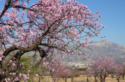
For those living near mountain valleys, especially near the east and south coasts, early February is the time of year to catch the beautiful almond blossom (pictured).
Many town halls run organised trips to the nearest almond orchards so residents can take selfies with the glorious pink flowering trees.